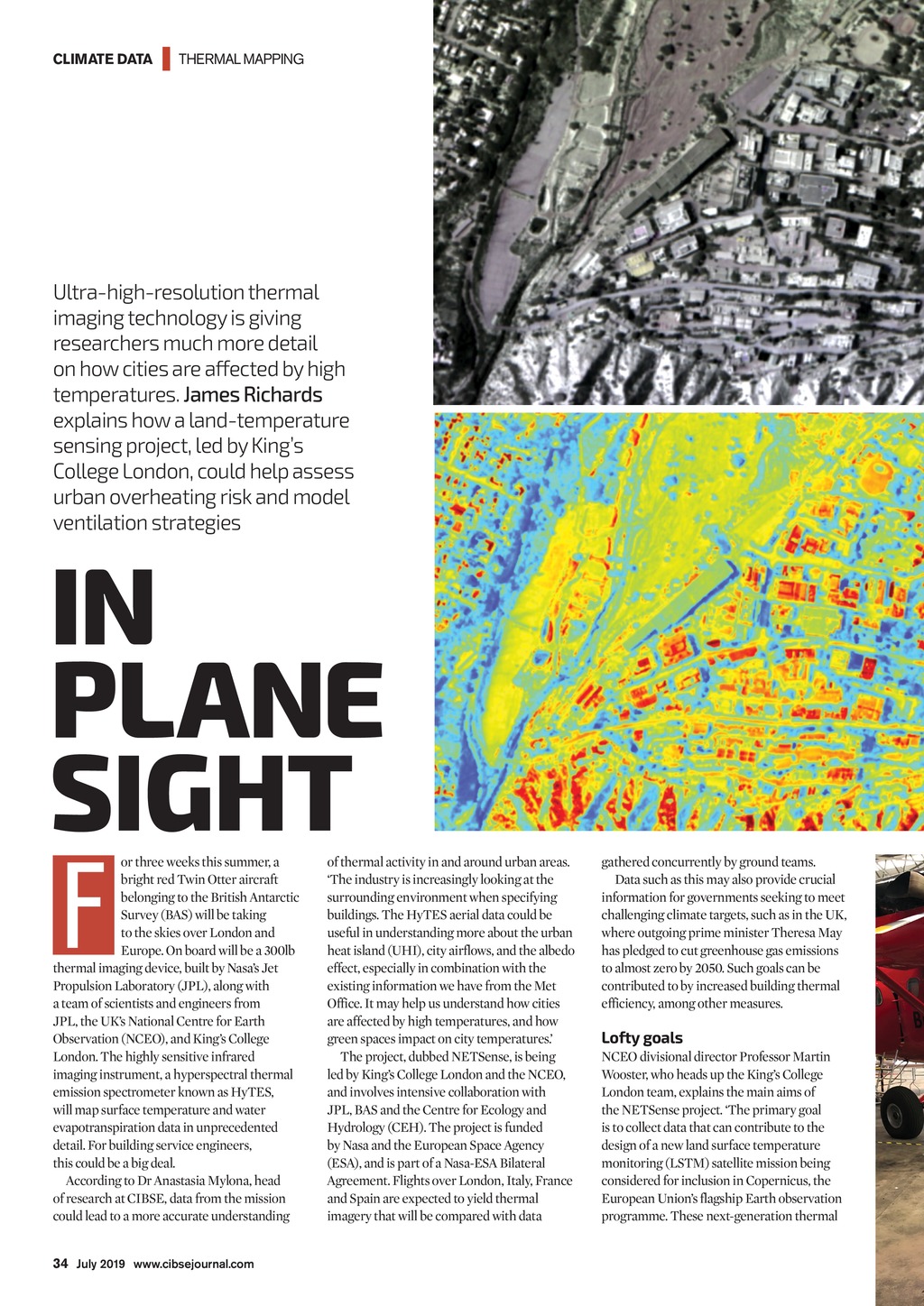


CLIMATE DATA | THERMAL MAPPING Ultra-high-resolution thermal imaging technology is giving researchers much more detail on how cities are affected by high temperatures. James Richards explains how a land-temperature sensing project, led by Kings College London, could help assess urban overheating risk and model ventilation strategies IN PLANE SIGHT F or three weeks this summer, a bright red Twin Otter aircraft belonging to the British Antarctic Survey (BAS) will be taking to the skies over London and Europe. On board will be a 300lb thermal imaging device, built by Nasas Jet Propulsion Laboratory (JPL), along with a team of scientists and engineers from JPL, the UKs National Centre for Earth Observation (NCEO), and Kings College London. The highly sensitive infrared imaging instrument, a hyperspectral thermal emission spectrometer known as HyTES, will map surface temperature and water evapotranspiration data in unprecedented detail. For building service engineers, this could be a big deal. According to Dr Anastasia Mylona, head of research at CIBSE, data from the mission could lead to a more accurate understanding of thermal activity in and around urban areas. The industry is increasingly looking at the surrounding environment when specifying buildings. The HyTES aerial data could be useful in understanding more about the urban heat island (UHI), city airflows, and the albedo effect, especially in combination with the existing information we have from the Met Office. It may help us understand how cities are affected by high temperatures, and how green spaces impact on city temperatures. The project, dubbed NETSense, is being led by Kings College London and the NCEO, and involves intensive collaboration with JPL, BAS and the Centre for Ecology and Hydrology (CEH). The project is funded by Nasa and the European Space Agency (ESA), and is part of a Nasa-ESA Bilateral Agreement. Flights over London, Italy, France and Spain are expected to yield thermal imagery that will be compared with data gatheredconcurrently by ground teams. Data such as this may also provide crucial information for governments seeking to meet challenging climate targets, such as in the UK, where outgoing prime minister Theresa May has pledged to cut greenhouse gas emissions to almost zero by 2050. Such goals can be contributed to by increased building thermal efficiency, among other measures. Lofty goals NCEO divisional director Professor Martin Wooster, who heads up the Kings College London team, explains the main aims of the NETSense project. The primary goal is to collect data that can contribute to the design of a new land surface temperature monitoring (LSTM) satellite mission being considered for inclusion in Copernicus, the European Unions flagship Earth observation programme. These next-generation thermal 34 July 2019 www.cibsejournal.com CIBSE July19 pp34-36 Temperature sensing.indd 34 21/06/2019 14:57