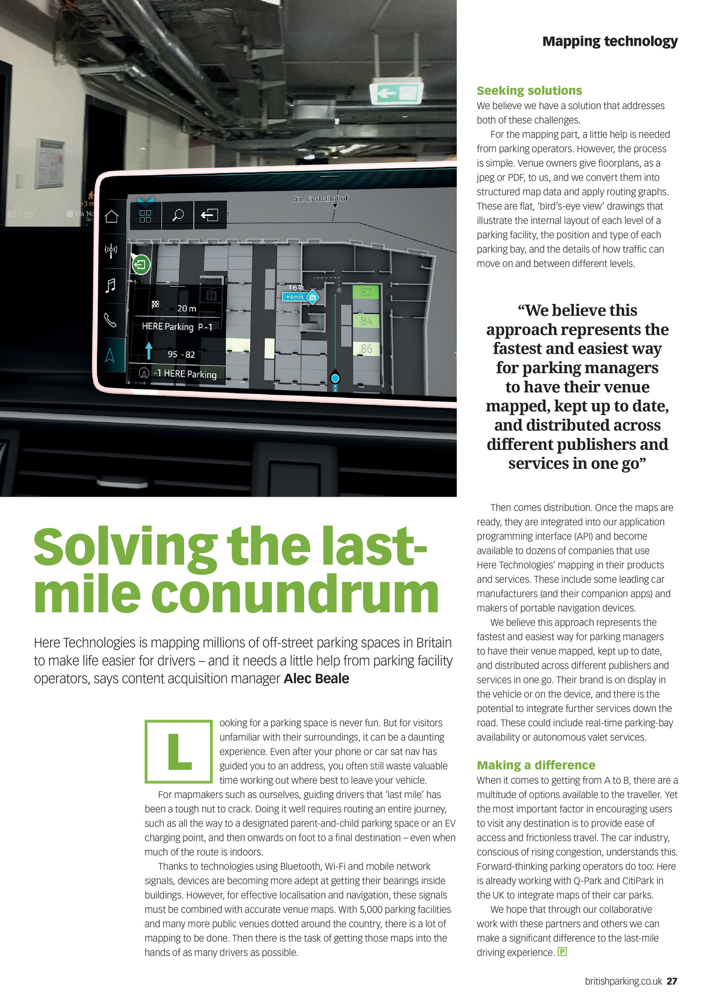
Mapping technology Seeking solutions We believe we have a solution that addresses both of these challenges. For the mapping part, a little help is needed from parking operators. However, the process is simple. Venue owners give floorplans, as a jpeg or PDF, to us, and we convert them into structured map data and apply routing graphs. These are flat, birds-eye view drawings that illustrate the internal layout of each level of a parking facility, the position and type of each parking bay, and the details of how traffic can move on and between different levels. We believe this approach represents the fastest and easiest way for parking managers to have their venue mapped, kept up to date, and distributed across different publishers and services in one go Solving the lastmile conundrum Here Technologies is mapping millions of off-street parking spaces in Britain to make life easier for drivers and it needs a little help from parking facility operators, says content acquisition manager Alec Beale ooking for a parking space is never fun. But for visitors unfamiliar with their surroundings, it can be a daunting experience. Even after your phone or car sat nav has guided you to an address, you often still waste valuable time working out where best to leave your vehicle. For mapmakers such as ourselves, guiding drivers that last mile has been a tough nut to crack. Doing it well requires routing an entire journey, such as all the way to a designated parent-and-child parking space or an EV charging point, and then onwards on foot to a final destination even when much of the route is indoors. Thanks to technologies using Bluetooth, Wi-Fi and mobile network signals, devices are becoming more adept at getting their bearings inside buildings. However, for effective localisation and navigation, these signals must be combined with accurate venue maps. With 5,000 parking facilities and many more public venues dotted around the country, there is a lot of mapping to be done. Then there is the task of getting those maps into the hands of as many drivers as possible. L Then comes distribution. Once the maps are ready, they are integrated into our application programming interface (API) and become available to dozens of companies that use Here Technologies mapping in their products and services. These include some leading car manufacturers (and their companion apps) and makers of portable navigation devices. We believe this approach represents the fastest and easiest way for parking managers to have their venue mapped, kept up to date, and distributed across different publishers and services in one go. Their brand is on display in the vehicle or on the device, and there is the potential to integrate further services down the road. These could include real-time parking-bay availability or autonomous valet services. Making a difference When it comes to getting from A to B, there are a multitude of options available to the traveller. Yet the most important factor in encouraging users to visit any destination is to provide ease of access and frictionless travel. The car industry, conscious of rising congestion, understands this. Forward-thinking parking operators do too: Here is already working with Q-Park and CitiPark in the UK to integrate maps of their car parks. We hope that through our collaborative work with these partners and others we can make a significant difference to the last-mile driving experience. britishparking.co.uk 27 PN Sep19 pp26-27 Here technologies.indd 27 22/08/2019 11:54